“There It Is. Take It!”
“There it is. Take it!” yelled William Mulholland as a torrent of water rushed down the Los Angeles Aqueduct to the roar of cannon fire and cheers from a crowd of 30,000. The 58-year-old self-taught civil engineer and head of the city’s water department had spent most of the past decade overseeing the construction of the 233-mile-long waterway, a feat of engineering contemporaries compared to the building of the Panama Canal. The aqueduct brought water from the Owens River, at the base of California’s Sierra Nevada mountain range. Mulholland’s singular vision of securing a water supply for the growing city of Los Angeles had finally come to fruition.
Nine years earlier, in September 1904, Mulholland accompanied his friend Fred Eaton, a former Los Angeles mayor, on a camping trip to the Owens Valley. Eaton had told him of the area’s potential as a water source. With Los Angeles’ population booming and its water supply under strain, Mulholland eagerly made the 250-mile trek by mule train with his friend to see the valley and river for himself. Eaton sold Mulholland on the idea of diverting the area’s water for the city’s use.
On Memorial Day weekend, I also set out for the valley on a camping trip, albeit with neither a mule train nor a desire to siphon off Owens River water to a major metropolitan area. I had planned the trip with my girlfriend, Emily, and one of our mutual friends, also named Calvin, hoping to see how the valley and the surrounding mountains looked after an exceptionally wet winter. While we had originally planned on backpacking into the Sierra, heavy snow forced us to opt for a regular car camping trip instead.

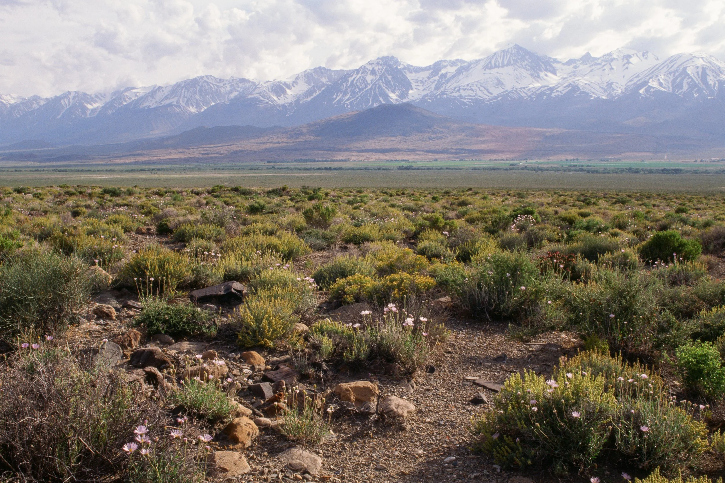
After a first day spent walking around Bishop and setting up camp, we spent the last few hours of the day driving and walking along backroads outside of town. We drove by acre after acre of pastures with grazing cattle and horses. Noticeably, we passed numerous signs denoting land which belonged to the Los Angeles Department of Water and Power (LADWP).


Eventually we stopped at a bridge over the Owens River. Its banks, swelled by unprecedented levels of snowmelt, had turned into marshes, which now reflected the late afternoon light. Unfortunately, the high water levels also bred swarms of mosquitos, which proceeded to descend upon us as we set up our cameras for sunset. The last few minutes of daylight turned into an ongoing battle of swatting away mosquitos while trying to enjoy the scenery.

With Mulholland thoroughly convinced by Eaton after their trip, the former mayor began purchasing tracts of Owens Valley land from locals, ostensibly for cattle grazing. Local ranchers, delighted by his attractive offers, eagerly sold their land. However, once it became clear that Eaton intended to turn over his land to Los Angeles for an aqueduct, the locals’ delight turned to anger. Eaton himself confessed that, “They say I sold them out…that I shall never take the water out of the valley; that when I go back for my cattle, they will drown me in the river.”
Despite residents’ vocal opposition to the aqueduct, the project began in earnest. Construction crews, working primarily with mule trains and a limited amount of mechanized equipment, constructed five reservoirs, 500 miles of road, and 142 tunnels. Despite the considerable engineering challenges, the aqueduct opened on time and under budget. Water now flowed freely to Los Angeles.
Over the next two decades, relations between the city and the Owens Valley’s ranchers and farmers grew increasingly antagonistic. The city continued buying more land and controlling more water rights. Some farmers held out, frustrated by what they saw as the city’s unacceptable offers for their land. In 1924, exasperated valley residents bombed a stretch of the aqueduct outside of Lone Pine. Yet the balance of power had shifted. Even a slew of subsequent explosions over the next few years could not delay the inevitable—the aqueduct was here to stay.
Once the Great Depression and the collapse of a local bank drove local farmers and ranchers into dire financial straits, most of the remaining holdouts sold their land to the city. By 1934, the city owned 95 percent of all the agricultural land in the valley.
In the century since the aqueduct’s construction, the conventional telling of the story has morphed into a salacious tale of water theft, made possible by intrigue, political corruption, and financial coercion. Popular media like Marc Reisner’s non-fictional book Cadillac Desert and the stylized 1974 movie Chinatown, loosely based on this history, has solidified this view.
In recent years, some scholars have pushed back against that popular narrative. UC Santa Barbara Professor Gary D. Libecap argues in his 2005 paper “Myth of Owens Valley” that due to the Owens Valley’s modest agricultural output, farmers, on average, benefited more from selling their land than if they had kept it. Based on his research, Libecap contends that Los Angeles’ purchases of local farmland merely hastened the inevitable shift away from relatively unproductive farming. He further notes that contrary to popular belief, holdouts received significantly more money for their land than those who sold theirs earlier, perhaps indicating a less sinister view of the city’s negotiating tactics.
Nevertheless, the legacy of the Los Angeles Aqueduct remains contentious. Local residents have maintained an uneasy relationship with the LADWP. The conventional view that Los Angeles stole the valley’s water persists, especially as the city attempts to balance its needs with those of local farmers and ranchers. Meanwhile, the Department continues to own a sizable chunk of the land in the Owens Valley and maintains its presence as one of the largest employers in Inyo County.

That historical background stayed on my mind as we continued our trip. After seeing sunrise outside of Bishop (also on LADWP land), we drove an hour south to Lone Pine, where a hundred years ago local farmers had blown up the aqueduct.
As we visited the nearby Alabama Hills and drove up to the trailhead for Mount Whitney, we could see the remnants of Owens Lake. The construction of the aqueduct meant that water which had once flowed into the lake now streamed towards Los Angeles. Within thirteen years, Owens Lake became a dry lakebed. Regular storms whipped up dust that contained heavy metals, causing surrounding communities to experience some of the country’s worst air quality.
In 1998, Los Angeles agreed to assume responsibility for dust mitigation efforts, which spanned an area the size of San Francisco. After two decades and $2.5 billion spent on a combination of flooding, irrigation, and the cultivation of meadows, LADWP has finally brought down dust pollution to manageable levels. In an unusual turn of events, we saw water covering much of the lakebed, yet another telltale sign of the unprecedented winter.

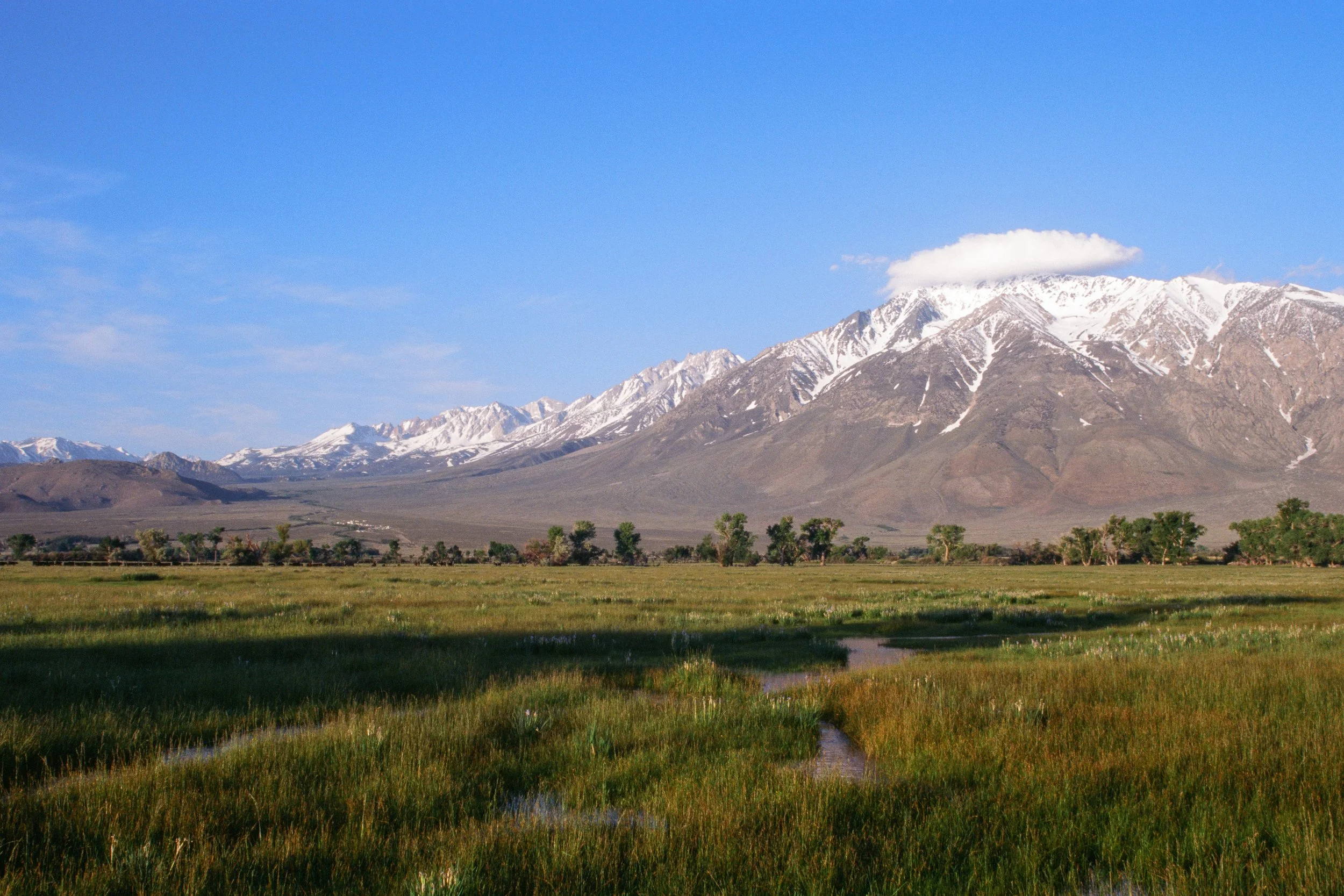
On our last day, we woke up again for another sunrise. I brought us to yet another familiar spot, a farmers’ pond, which I had visited back in January with another group of friends (again on LADWP land). This time, the vegetation around the pond looked lush. Unfortunately, we encountered ravenous swarms of mosquitos yet again.
Emily understandably decided to seek refuge away from the bugs by staying inside the car until the sun rose. My desire to photograph the sunrise outweighed my reluctance to get stung, so I wandered around the bushes trying to outrun the mosquitos. As I had already photographed one scene here in January, I wanted to look for a different composition.
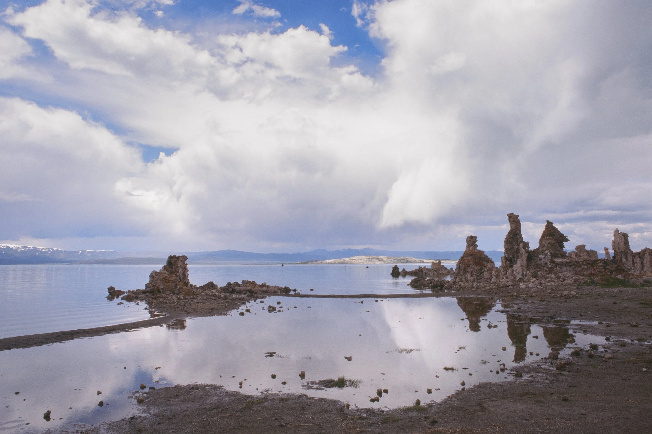
I walked off towards a quieter corner of the pond and found some reeds sticking out of the lake. The lack of wind that morning helped to keep the water surface still, revealing a crystal-clear reflection of Wheeler Ridge at the northern end of the valley. For a moment, I stopped caring about the mosquitos as I excitedly set up my camera for the shot.

After spending the rest of our morning in Bishop, we started on our drive back home. Along the way, we took a slight detour and stopped by Mono Lake, an alkaline lake which hosts a diverse ecosystem. In 1941, Los Angeles extended its pipes further north, siphoning water from the streams which flowed into the lake. Over the next four decades, the diversions lowered the lake’s surface level by 45 feet, halving its volume and doubling its salinity. The changes threatened the area’s wildlife. Low water revealed a land bridge connecting Negit Island to the mainland, exposing migratory birds’ nests to predators. The high salinity threatened the lake’s brine shrimp, a vital food source for birds.
After decades of activism and legal action, in 1994 the State Water Board limited the city’s ability to withdraw water and set a target water level—at 6,392 feet above sea level—to be reached by 2014.
As we hiked down from the parking lot to the shoreline, we walked past signs noting the lake’s surface level in 1941 (6,417 feet above sea level) and stared in astonishment at how far away the markers stood from the present-day shoreline.
Around the time of our visit, the Mono Lake Committee, a local conservation group who played an instrumental part in spurring the 1994 decision, petitioned the state government to halt Los Angeles’ diversions. The 2014 deadline came and went as the state suffered a severe drought. Despite this past winter’s record-breaking snowpack and the fact that the city has cut its outflows by 85 percent since the 1990s, the lake’s water levels now hover at around 6,382 feet above sea level, ten feet shy of the 1994 target. As of writing, the state water board still has not issued a decision regarding the committee’s request.
William Mulholland’s work as Los Angeles’ water chief secured his place as one of the city’s preeminent public figures. Yet his reputation would not last. In 1928, the St. Francis Dam, built under his supervision to store some of the water from the aqueduct, collapsed twelve hours after the chief had personally inspected it. Over four hundred died in the ensuing flood. Mulholland stepped down from his post with his reputation tarnished.
Nevertheless, his legacy lived on. In 1900, 102,000 people lived in Los Angeles. By 1930, that number had exploded to 1.2 million. Today, 3.8 million people live in the city, now the second largest in the United States. The aqueduct, which made that growth possible, still supplies 29 percent of Los Angeles’ water.
Despite this winter’s record snowfall, California’s long-term water situation remains precarious. The Sierra Nevada provides sixty percent of the state’s freshwater. In an average spring, its snowpack alone contains the equivalent of two-thirds of the water stored in all of California’s reservoirs. In the coming decades, warmer temperatures will cause more of the Sierra’s precipitation to fall as rain instead of snow. Any existing snow will also melt faster, increasing the risk of floods and the instability of the state’s water supplies. UCLA climate scientists Neil Berg and Alex Hall estimate that the average Sierra snowpack may decrease by 60 to 85 percent by the end of this century. As climate change intensifies the swings between wet and dry years, managing California’s water supply will become an increasingly difficult task.
Yet these concerns felt a bit less urgent that weekend. As we drove back home, another storm rolled through the mountains, bringing yet more rain and snow.